


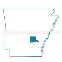
P83 Voting District, Jefferson County, Arkansas
About
Outline

Summary
| Unique Area Identifier | 526924 |
| Name | P83 Voting District |
| County | Jefferson County |
| State | Arkansas |
| Area (square miles) | 1.77 |
| Land Area (square miles) | 1.74 |
| Water Area (square miles) | 0.03 |
| % of Land Area | 98.41 |
| % of Water Area | 1.59 |
| Latitude of the Internal Point | 34.25801070 |
| Longtitude of the Internal Point | -92.00091180 |
Maps


Graphs
Select a template below for downloading or customizing gragh for P83 Voting District, Jefferson County, Arkansas


Neighbors
Neighoring Voting District (by Name) Neighboring Voting District on the Map
- 48 Voting District, Jefferson County, AR
- 74 (Vaugine) Voting District, Jefferson County, AR
- P105 Voting District, Jefferson County, AR
- P401 Voting District, Jefferson County, AR